More than 20,000 people paddle the 280 miles of the Colorado River through the Grand Canyon every year. The National Park Service offers permits through a lottery system that allows one Grand Canyon river trip per person per calendar year, if you’re lucky.
Permits are tough to win, making the Grand Canyon river trip one of the most coveted multi-day river trips in the world. And in a stressful year like 2020, getting the chance to spend two or three weeks in a remote canyon, away from other people, away from cell phones, and away from news, was an opportunity like no other.
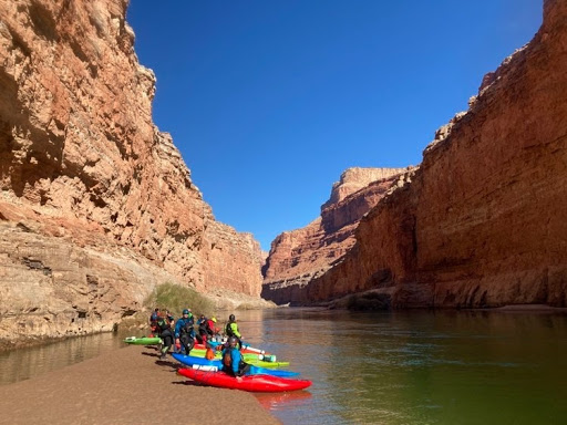
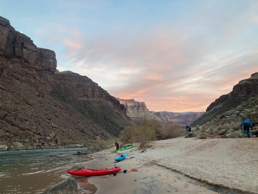
On December 20th, myself and fifteen friends launched from Lee’s Ferry, Arizona. Sixteen kayakers packed fourteen days’ worth of food and winter gear into our kayaks. The 12-foot-long whitewater kayaks we used have compartments behind our seats and in front of our legs perfect for gear storage. However, these compartments are not large, which makes packing for a trip like this a fine balance of weight and volume.
Just because we were trying to cut down on weight and volume, doesn’t mean we left behind the fun items! Utilizing every spare square inch in the kayak, one group member was able to fit 56 beers, while another packed an entire Spikeball game set. Another brought two tubes of cinnamon rolls – meant for Christmas and New Years mornings, while I brought a five-pound bag of neon sour gummy worms. You never know what you might need while on a fourteen-day expedition down a remote river canyon.
A river trip through the canyon is not only an experience of the river and the people you are paddling with, but also an experience of the geologic history that took place millions of years ago in that region.
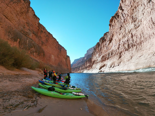
Emptying out of Lake Powell from the gates of the Glen Canyon Dam in northern Arizona, the Colorado River flows 280 miles through one of the most spectacular river canyons in the world.
The Grand Canyon’s geologic history began around two billion years ago when lava flows cooled, forming igneous granite and basalt rocks. Some of those rocks were then heated and pressurized in the interior of the Earth’s crust, creating metamorphic rock on top of the igneous basement rocks. Over time, sediment was deposited on top of these basement rocks in the form of limestone and sandstone layers.
Between 70 and 30 million years ago, the region where the Grand Canyon now exists was uplifted through tectonic plate processes to form the Colorado Plateau. The Colorado Plateau encompasses part of Arizona, Colorado, Utah and New Mexico and contains many desert geologic spectacles, including Arches National Park, Bryce Canyon National Park, and Zion National Park.
Driving across Nevada and into Arizona, the contrast between Nevada’s dry desert mountains and the crazy red rock formations of the Colorado Plateau was clear.
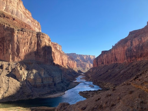
As the Colorado River cut its way through the uplifted rock of the Colorado Plateau, it carved out massive canyon walls that display a clear cross-section of all the geologic layers present in the Colorado Plateau. The river winds through the canyon, starting in the upper-most and youngest layer of rock, and eroding its way downstream into the older and lower-lying layers of bedrock.
As you descend deeper into the depths of the canyon, each bend in the river displays a different and older layer of rock; beginning with limestone and sandstone sedimentary layers, and descending all the way down to schist, granite and basalt igneous and metamorphic layers.
The morning of our launch date, Peggy, the Grand Canyon Park Ranger, gave us a well-rehearsed “safety and leave-no-trace” speech. Being my second trip down the Canyon, I had heard the speech before. But this time, her speech had new safety precautions. “Masks must be worn at all times while at Phantom Ranch,” and “No hiking, boating, or going up Havasu Canyon AT ALL.”
Havasu Canyon was formed by Havasu Creek, which is bright blue in color, almost mirroring the color of the sky on a clear day. Havasu Creek is a tributary of the Colorado River, meaning it flows into the Colorado River, causing the two waterways to become one. The confluence of Havasu Creek and the Colorado River is deep in the canyon, after the river has already winded its way through numerous geologic layers.
The bright blue color of Havasu Creek is caused by large amounts of travertine in the water, which has been precipitated from groundwater flowing through the Canyon’s many limestone layers, which are some of the upper-most layers in the canyon’s geologic cross-section.
In response to the pandemic, the Havasupai Tribe, whose reservation lies deep within the walls of the Grand Canyon, has closed their land off to the public. While this was initially a disappointment for some members of our group, we all agreed that the decision to close the Havasupai reservation was the right call on the Tribe’s part.
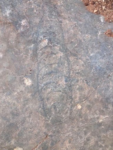
On the second night of our trip, we made camp at the base of Nautiloid Canyon. We awoke early and packed our kayaks quickly the next morning so we would have time to explore the canyon before getting on the river. Hiking up the canyon, the limestone we were walking on was steep, and we had to climb using our hands on three separate occasions.
Nearing the top of the canyon (or at least the top of where we would be able to go without rope access), I spotted a massive fossil at my feet. A large Nautiloid shell, dated to have lived 400 million years ago, was encased in the limestone layer I was walking on. Nautiloids are believed to have been relatives of the modern chambered nautilus, which is a mollusk similarly related to squid and octopus.
As we continued down the river, the Canyon’s walls shifted from limestone to sandstone to shale, back to limestone, more shale, more sandstone, then granite, basalt, quartzite, and schist. Each day, we descended further into the depths of the Canyon, and each day, we saw an older layer of geologic history. And with the deepest point in the Grand Canyon being over a mile of vertical drop away from the rim of the canyon, we had a lot of geologic history to explore. And with fourteen days to explore it, we had plenty of time.
Fourteen days of living out of a kayak on the Colorado River, in one of the most spectacular canyons in the world was a break from reality like none other. And in the days of the COVID-19 pandemic, we made sure not to take that break for granted.
Photo by Brooke Hess 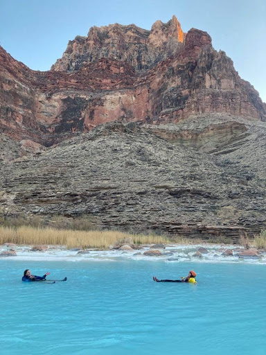
Swimming in the bright blue color of the Little Colorado River. Photo by Brooke Hess. 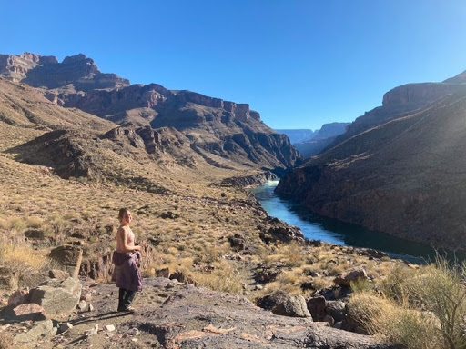
Ally Metts poses on a hike above the river. Photo by Brooke Hess. 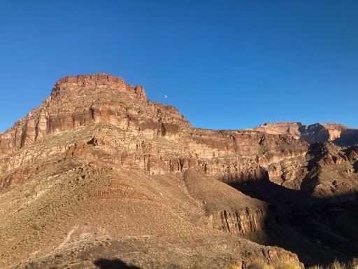
Photo by Brooke Hess Photo by Brooke Hess 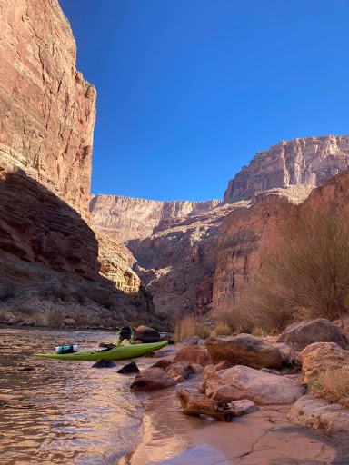
Photo by Brooke Hess 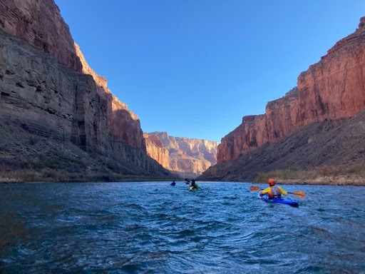
Photo by Brooke Hess 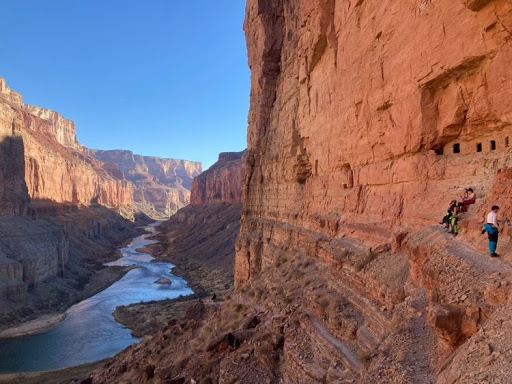
The Nankoweap Granaries above a downstream view of the Grand Canyon. Photo by Brooke Hess. 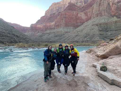
Photo by Brooke Hess Looking down the river from the Nankoweap Granaries. Photo by Brooke Hess. Photo by Brooke Hess 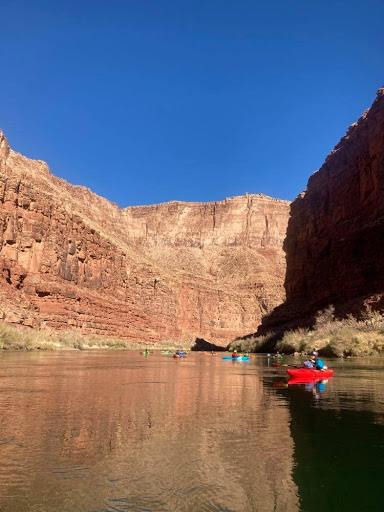
Photo by Brooke Hess 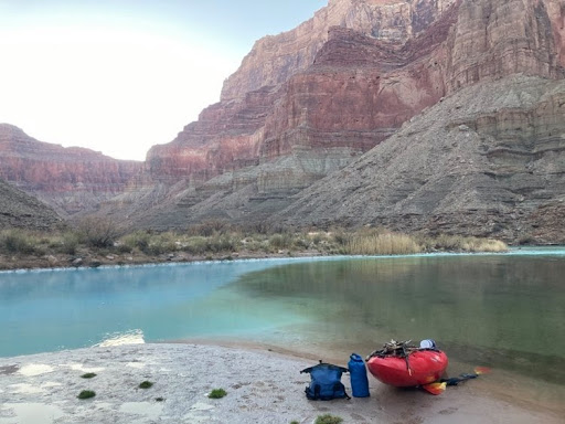
The confluence of the Colorado River and the Little Colorado River. Photo by Brooke Hess. Naudiloid fossil. Photo by Brooke Hess. 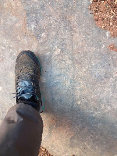
Nautiloid fossil. Photo by Brooke Hess.